🌊 Navigate Your World with Style!
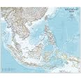
The Pacific Ocean Wall Map measures 34" x 27.75" and is printed on durable polypropylene, ensuring it withstands the test of time. With a scale of 1:30,000,000, this political map features all Pacific islands clearly labeled, making it an ideal decorative and educational piece for any professional space.
| Manufacturer | MapSherpa |
| Brand | HEMA |
| Item Weight | 14.4 ounces |
| Material Type | Matte Plastic |
| Sheet Size | 35 x 28.5 Inches |
| Paper Finish | Matte |
| Manufacturer Part Number | 697942004441 |
A**E
Excellent!
I bought this map to help me better understand how the Hawaiian Islands are situated in the Pacific, especially in relation to the US Mainland as well as to other countries. Well, it certainly did that and also demonstrated Hawaii's truly remote location. After informing me for awhile, I decided to donate this excellently crafted and well laminated map to a Hawaiian fourth grade classroom in need of a map. They love it and frequently consult it. So glad I made this purchase.
A**R
Incredible detail!
I am a sailor wanting a good map for the many nations and islands of the Pacífic. This map offers superb detail. Most any destination you seek will be found. I highly recommend this.
M**A
The best map to study WW2
This map even has the dot to represent the Russell Islands Pavuvu & Mbanika.
J**M
Good detail
Got this to track my son’s adventures on deployment. Nice and big. Good detail.
P**A
high quality laminate
the map came packaged safely. I'm really happy with it.
E**S
Great.
Very nice I love it. Thanks.
J**D
Poorly designed, incomplete, amateurish map making
It is so skewed to the northern hemisphere that it doesn’t include southern Chile, Cape Horn or ANY of the Pacific below 53S. To the north it represents the Bering sea all the way up to 63N, nearly to the Arctic, way more than needed for a map of the Pacific. I’m disappointed by the thoughtless layout of this map titled the PACIFIC OCEAN. Pretty lame at any price.However, the printing and material seem to be of good quality
M**E
Beautiful - small omissions (literally)
beautiful map - I wish Hema map more detailed maps for other regions, like parts of Africa, the Caribbean, and the Indian ocean.BUT - so far, after about a month of staring at this on my wall, i've notice at least one missing island - Japanese Atoll of Minami-Tori, coordinates from wikipedia: 24°17′12″N 153°58′50″EAt the same time the detail of the tiny islands is amazing - when using a magnifying glass you can see the accurate contours of even the smallest islands and atolls.great map and beautiful to look atI marked my map by drawing it over a piece of tape. not a big deal though. I will try and update this review if i notice any other mistakes.Updates:none as of 8.9.20
Trustpilot
1 day ago
2 months ago